
01
Executive overview
Key findings
About 90%: share of the District's water supply conveyed through the three Mokelumne Aqueducts, about 10 miles of which run above ground across the Sacramento–San Joaquin Delta
About 364,000 acre-feet a year: Mokelumne River diversions allowed under the District's water rights, against annual production below 190,000 acre-feet in each of FY 2016–FY 2025
133,000 acre-feet: maximum federal Central Valley Project delivery in a single dry year, taken through the Freeport Regional Water Project at up to 100 MGD
October 29, 2026: the State Water Resources Control Board adopted the Bay-Delta Plan update, whose voluntary pathway is to begin by October 1, 2027
02
Buyer relevance
Who the report is for
Water resources and environmental consultants
Map the District's Mokelumne rights, prior rights downstream and fish releases against the October 29, 2026 Bay-Delta Plan and its October 1, 2027 start.
Water transfer and groundwater banking partners
See the size and status of each dry-year source, from the 133,000 acre-foot federal contract to the Placer County agreement expected in late 2027.
Infrastructure investors and lenders
Review storage, aqueduct, treatment and wastewater capacities alongside the US$2.86 billion water capital program and its 49% bond funding.
Public agencies and policy analysts
Identify which joint authorities and regulators hold decisions over Freeport deliveries, recycled water, watershed work, discharge permits and hydropower.
03
Decision scope
Questions answered
How much Mokelumne water can the District take?
Its rights allow about 364,000 acre-feet a year, while the water it produced each year stayed below 190,000 acre-feet in each of FY 2016 to FY 2025.
How full was the system in 2026?
Total system storage was 624,310 acre-feet on March 1, 2026, 81% of capacity, and 684,000 acre-feet on April 15, 2026.
What dry-year water can it import?
Up to 133,000 acre-feet from the federal Central Valley Project in a single dry year, delivered through the Freeport project at up to 100 MGD.
How much water does the system lose?
The 2025 Urban Water Management Plan reports 4,828 million gallons of loss on 56,124 million gallons supplied in calendar 2024, with real losses of 26.3 gallons per connection a day.
04
Inside the report
Inside the complete report
Executive Overview
1. Water Resource Profile
2. Governance and Institutional Framework
3. Infrastructure and Service Delivery
Strategic Outlook and Opportunities
Source Register
05
Public preview
What to watch next
1. Water Resource Profile
Office of Administrative Law approval of the Bay-Delta Plan and the pathway applied to the Mokelumne; the Placer County agreement; the groundwater banking memorandum; the next Water Supply Availability and Deficiency Report in April 2027.
Strategic Outlook and Opportunities
The FY 2028–FY 2029 budget and rate proposal in spring 2027; the Bay-Delta Plan implementation framework; the Nutrients Master Plan Update; the Placer County transfer; a decision on the Delta tunnel.
2. Governance and Institutional Framework
Ward 3 and Ward 7 results; Bay-Delta Plan implementation steps; the Ninth Circuit appeal on the federal contract; the tiered-rate class action and the California Supreme Court's review of a related Los Angeles rate case granted March 11, 2026.
3. Infrastructure and Service Delivery
Treatment plant completion dates; FY 2027 pipeline replacement and break rates; wet weather compliance under the reissued main plant permit.
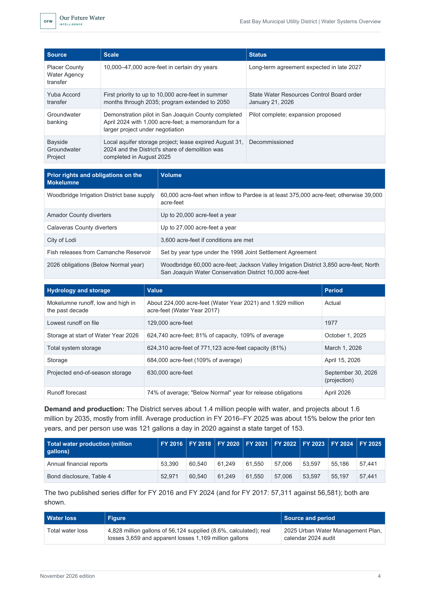
Water resource profile: prior rights on the Mokelumne, 2026 hydrology and storage, and annual water output.
06
Included
What you receive
The complete PDF report: 12 pages, 6 sections, 14 tables and a register of 17 sources.
This edition
November 2026, First edition.
07
Evidence & method
Evidence and method
The report draws on the District's 2026 water and wastewater bond Official Statements, its FY 2026 audited statements and annual financial reports for FY 2016 to FY 2025, and its 2025 Urban Water Management Plan and 2026 supply report. It also uses Board records, state and regional regulatory documents and state announcements on the Bay-Delta Plan.
Sources
17 sources, listed in the report's source register. Evidence current to 6 November 2026. Principal data periods: FY 2026 audited results (year ended June 30, 2026); Water Year 2026 supply conditions; FY 2016–FY 2025 operating series; FY 2026–FY 2030 capital forecast. All currency is US dollars..
Evidence boundaries
This report uses authoritative source material available at the stated research cutoff. It distinguishes published facts, calculated values and analytical interpretation. No independent modelling is performed. Forward-looking analysis reflects published plans, documented trends and stated uncertainties. It does not constitute legal, financial, investment or engineering advice.
08
Lead analyst
Robert C. Brears
Founder, Our Future Water Intelligence
Robert C. Brears is a water-security specialist and author whose work examines utility governance, infrastructure investment, climate resilience and long-term water-system change for executive and policy audiences.
- Decision-focused utility intelligence
- Published water-policy author
- Evidence-grounded system analysis
09
Buyer FAQs
Before you purchase
Who can use the report?
Licensed for internal use within one purchasing organization. The PDF and its contents may be shared with colleagues within that organization. External redistribution, resale and public publication are prohibited without permission.
How is the report delivered?
The PDF is available to download immediately after confirmed payment, through our secure delivery system.
Can my organization buy wider access?
Institutional purchasing: For invoice enquiries, multi-organization licensing or broader access requirements, contact Our Future Water Intelligence.
10
Water Systems Overview: East Bay Municipal Utility District
- Format
- Length
- 12 pages
- Edition
- November 2026, First edition
- Price
- USD 499
11
Report details
Publication details
- Publisher
- Our Future Water Intelligence
- Report family
- Water Utility Intelligence Report
- Edition
- November 2026, First edition
- Format
- Length
- 12 pages
- Reference
- OFW_EXT_WATER_SYSTEMS_OVERVIEW_EAST_BAY_MUNICIPAL_UTILITY_DISTRICT_63b2cac65ed3
- Evidence current to
- 6 November 2026
14
Explore this report family
More Water Systems Overview reports
Explore the same report family covering other utilities.
Water Systems Overview: Aguas Andinas
- Geography
- Greater Santiago, Metropolitan Region, Chile
- Edition
- November 2026, corrected edition
- Length
- 11 pages
Water Systems Overview: Berliner Wasserbetriebe
- Geography
- Berliner Wasserbetriebe
- Edition
- October 2026, First edition
- Length
- 11 pages
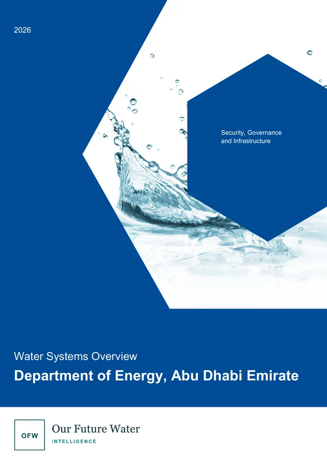
Water Systems Overview: Department of Energy, Abu Dhabi Emirate
- Geography
- Department of Energy, Abu Dhabi Emirate
- Edition
- October 2026, First edition
- Length
- 14 pages